
English| EUR
Suggested for you
More currencies
Choose a language
The water route between Annapolis and St Michaels crosses one of the Chesapeake Bay's most accessible stretches. This guide breaks down the distance, the waterway you'll navigate, and the conditions that shape the journey.
Quick answer
The annapolis to st michaels by boat distance measures approximately 24 nautical miles when following the standard route through Eastern Bay. Most recreational vessels complete the passage in three to four hours under calm conditions, though wind, current, and boat speed affect actual transit time. Daylight navigation between 08:00 and 16:00 is strongly recommended for visibility of channel markers and safe passage.
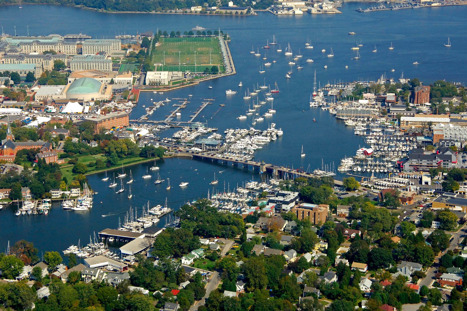
The crossing from Annapolis to St Michaels ranks among the Chesapeake Bay's most straightforward recreational passages, yet the annapolis to st michaels by boat distance guide reveals nuances that separate smooth transits from taxing ones. The 24-nautical-mile route departs Annapolis Harbor, threads southeast past Bloody Point Bar Light, and enters Eastern Bay before turning northeast toward the Miles River entrance at St Michaels. Unlike open-water crossings, this passage benefits from the shelter of Kent Island to the east and the gradual shallowing of Eastern Bay's western shore. Navigators track three distinct segments. The first leg runs from the Severn River mouth to the red-and-green buoy marking Bloody Point shoal, a stretch of roughly eight nautical miles where tidal currents accelerate around Thomas Point Shoal Light. The second segment crosses Eastern Bay's center channel, where depths hold between 15 and 25 feet and fetch allows waves to build during southwest winds. The final approach into the Miles River narrows near Tilghman Point, where the channel bends and pleasure craft traffic concentrates during weekend hours. Current sets the pace. Ebb tides flowing out of the Severn and flood tides pushing into Eastern Bay can add or subtract an hour from the passage, and spring tides during new and full moons amplify the effect. Mariners departing Annapolis on a favorable ebb often reach Bloody Point Bar Light within 90 minutes, while those fighting an incoming flood may motor hard for two hours to cover the same water. Cruising sailboats average five to six knots under power; planing powerboats shorten the voyage to 90 minutes when sea state allows. The Miles River entrance requires attention. The marked channel swings north past red daymark "2" before the final turn toward St Michaels Harbor, and shoaling along the eastern shore has caught inattentive skippers. Once inside the harbor's protected water, transient slips and mooring fields lie within a quarter mile of the town center, putting visiting boaters steps from the Chesapeake Bay Maritime Museum and the working waterfront that defines the community.
“The passage benefits from the shelter of Kent Island to the east and the gradual shallowing of Eastern Bay's western shore.”
The voyage from Annapolis to St. Michaels typically spans approximately 20 to 25 nautical miles across the Chesapeake Bay. Navigators generally transit east across the bay, passing south of Kent Island before entering the Eastern Bay and navigating the Miles River toward St. Michaels.
Chesapeake Bay to Eastern Bay (via Kent Narrows or south of Kent Island)
Annapolis Harbor to Miles River approach
Check local weather patterns and tidal currents for the Miles River, as conditions can change rapidly in the Eastern Bay. Daylight navigation is recommended for safe passage and visibility of navigational aids.
The transit between Annapolis and St. Michaels by boat is a waterway passage that requires no entrance fees for navigation. Costs associated with this journey primarily hinge on private or public docking fees at your destination.
Verdict: A typical boater pays 0 USD for the transit itself, though arrival costs vary based on chosen marina slips.
The transit route between Annapolis and St. Michaels remains accessible at all times, allowing for flexible departure planning across the Chesapeake Bay.
Ensure safe passage across Chesapeake Bay by preparing the right equipment and documents before departure.
Everything you need to know about annapolis to st michaels by boat distance
The travel distance across the Chesapeake Bay between these two historic ports is approximately 20 to 25 nautical miles depending on your specific departure point and destination marina. Sailors and cruisers often enjoy this scenic crossing as a classic regional voyage.
Navigating the route is generally straightforward for experienced boaters, though it requires attention to channel markers and weather conditions. Proper chart plotting ensures you maintain the correct course across the open water.
Daylight navigation is highly recommended to maintain visibility of navigational aids and ensure safe passage. Following this practice helps avoid potential hazards while crossing the bay.
While the geographic annapolis to st michaels by boat distance remains constant, actual travel time varies significantly based on boat speed and sea state. It is wise to check marine forecasts before departing your dock.
There is 0 USD in entrance fees for boat transit between Annapolis and St. Michaels. You are free to navigate these public waterways at your convenience.
The best arrival window for your voyage is 08:00–16:00. Arriving during these hours ensures you have ample daylight for docking and securing your vessel at the harbor.